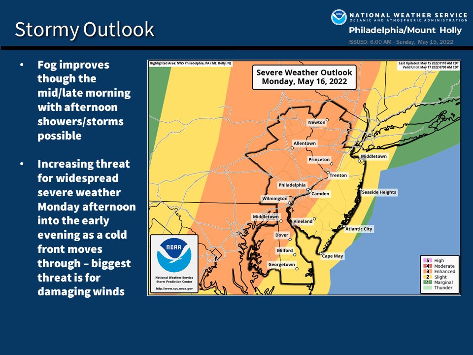
We are looking at a threat for widespread and potentially significant severe weather across the area Monday afternoon into the evening as a cold front moves across the area west to east.
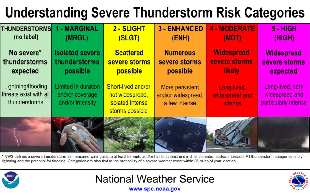
Locations affected: The threat exists region-wide, but the highest threat of widespread significant severe weather is roughly for areas around and north/west of the I-95 corridor (see attached graphic) where the Storm Prediction Center has indicated an “enhanced” risk for severe weather Monday.
Timing: 2 PM to 9 PM, earliest over our western zones from Berks County northward through the Lehigh Valley and the southern Poconos and latest near the coast. For the Greater Philadelphia area, the best chance for severe weather looks to be between roughly 4 and 7 PM.
Impacts: Damaging straight line winds over 60 mph and large hail. Storms will also be capable of producing very heavy rainfall with localized flooding. However, the system looks to be progressive enough to preclude a significant flash flood threat.
For further forecast details, please visit the National Weather Service’s website at www.weather.gov/phi. Further information is also available at https://www.spc.noaa.gov/